CASE STUDY
Energy & Infrastructure
Verkís: Grindavík Defense Structure Mapping & Volcano Monitoring
Svarmi's DATACT platform, used throughout Verkís for managing all drone data and photos, is proving critical in mapping the volcanic defense barriers protecting Grindavík, Iceland. Its ability to rapidly process and deliver data supports vital construction monitoring within minutes to hours during the ongoing volcanic emergency.

About
Verkís
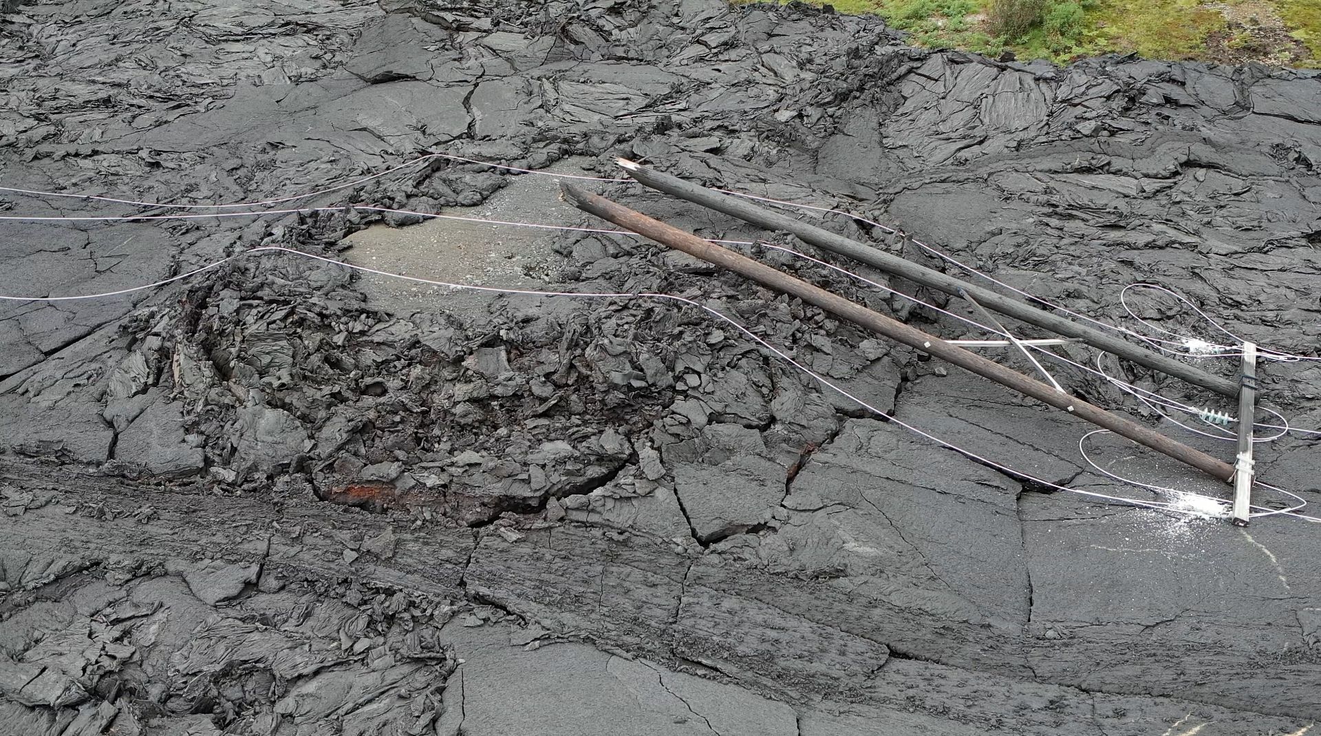
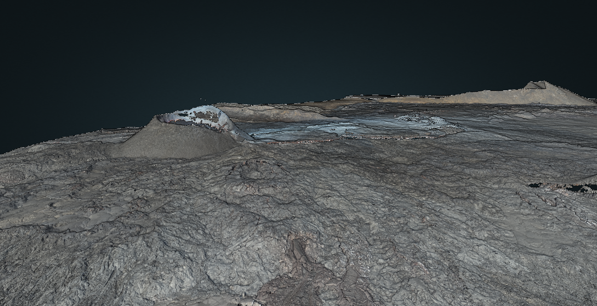
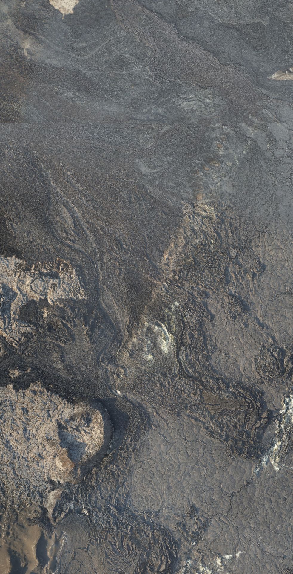
Verkís, a leading engineering consultancy, has been tasked with constructing protective barriers to defend the town of Grindavík, the Svartsengi geothermal power plant, and the Blue Lagoon from advancing lava flows during an ongoing volcanic eruption. This critical infrastructure project requires precise, frequent mapping to monitor construction progress and adapt to changing lava flow patterns in real-time.
The Challenge
Challenge
The volcanic emergency near Grindavík presented unique operational challenges that demanded immediate solutions. Verkís needed to map defensive barriers multiple times per week to assess construction pace against rapidly changing lava flows threatening valuable infrastructure and residential areas. The project required a data processing solution that could handle large volumes of drone imagery quickly and reliably, with fast turnaround times essential for making critical construction decisions. Traditional data processing methods were too slow for this emergency response scenario, where delays could mean the difference between saving or losing critical infrastructure.

The Solution
how we did it
Verkís selected Svarmi's DATACT platform to streamline their drone data processing workflow. The cloud-based solution allows field teams to simply upload drone imagery to DATACT upon returning to the office, send relevant Ground Control Point (GCP) data to Svarmi, and receive processed, downloadable data within 12-24 hours via email notification. According to Andrés Gísli Vigdísarson from Verkís, the platform's intuitive interface provides excellent data overview capabilities, while Svarmi's responsive customer service ensures direct access to data processing specialists—crucial for a fast-moving emergency project where rapid data delivery can impact life-safety decisions.

Implementation
& Experience
Learn more
about DATACT