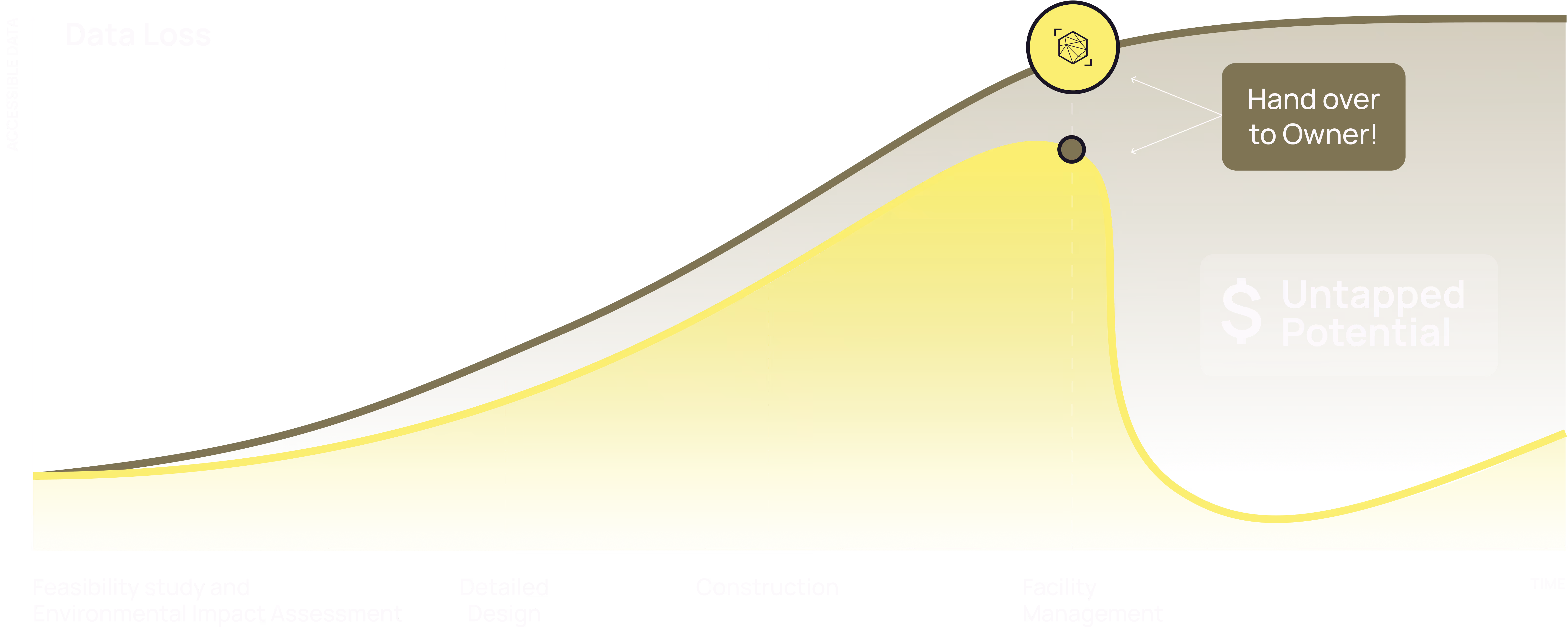
Centralized Environmental Data
Nature & Data Housekeeping with DATACT
DATACT is your secure hub for storing, viewing, and understanding nature-related data—from species observations and field photos to organic matter and environmental pressures.
Nature & Data Housekeeping
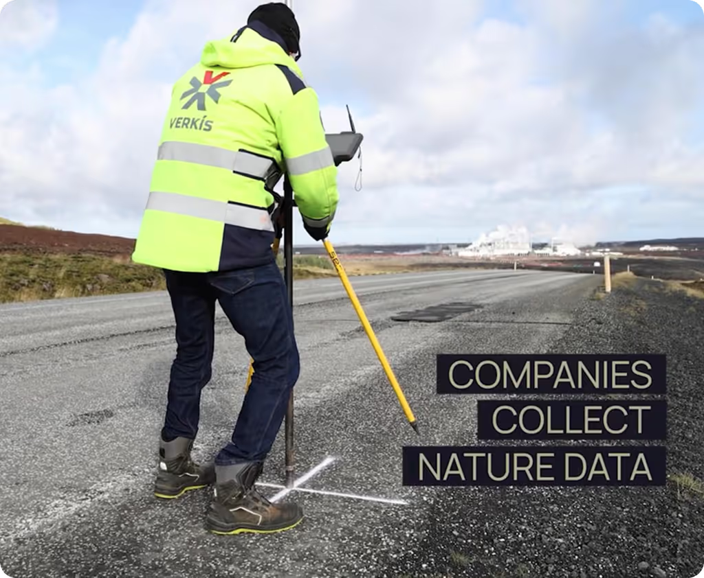
Environmental data is often scattered and hard to access. With DATACT, all your Environmental Impact Assessment files and local field observations are stored in one secure, map-based platform—making everything easy to find, share, and use for better decision-making.

We built DATACT
data control
Control your data
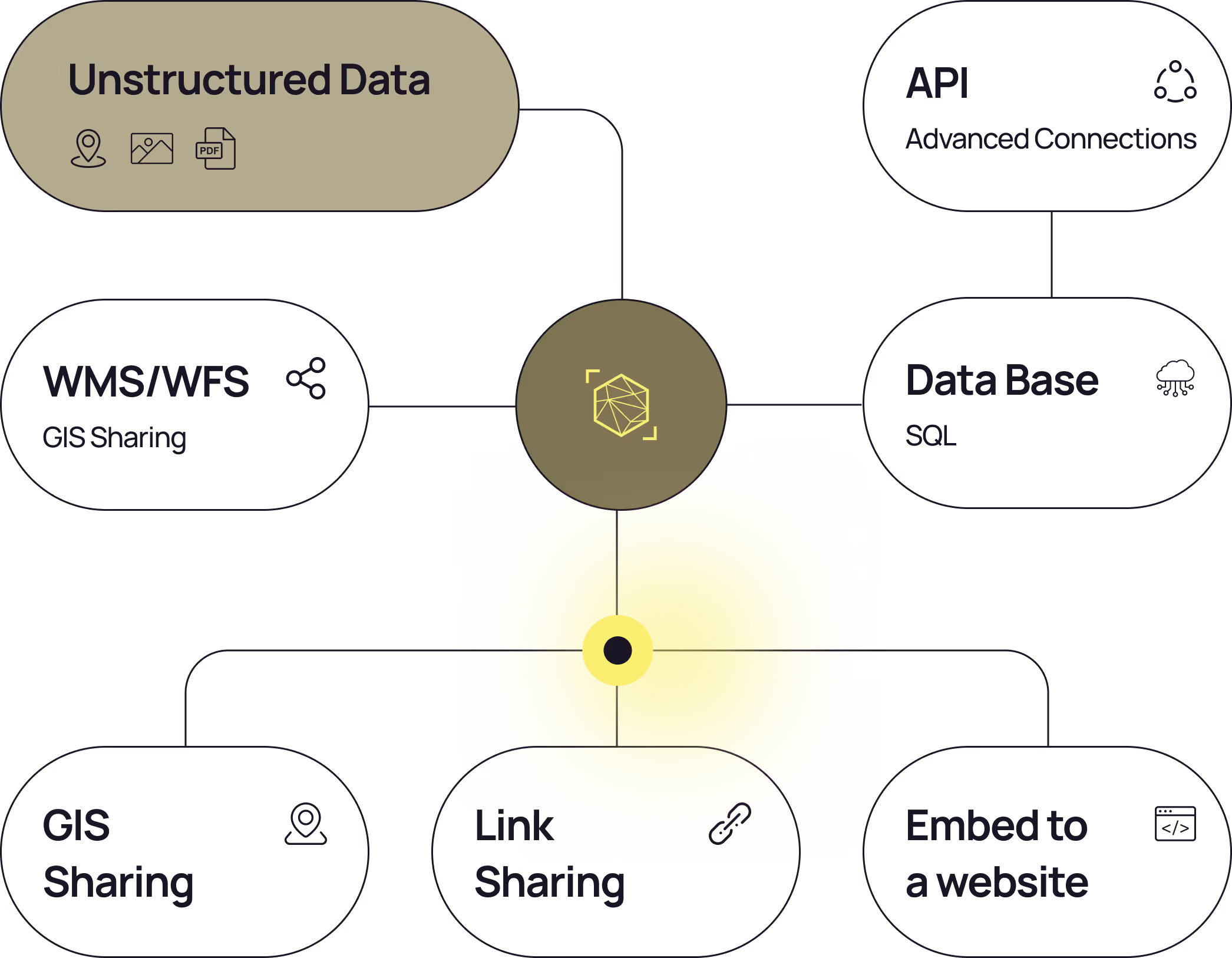
Flexible Delivery Models
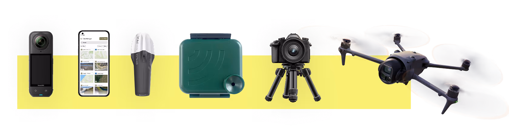
Through the software solution, our clients can onboard relevant data, including data collected by your teams and third-party data from satellites and local drone operators. Our nature data management software to address this.
Manage your assets and their impact
Advanced sharing and management
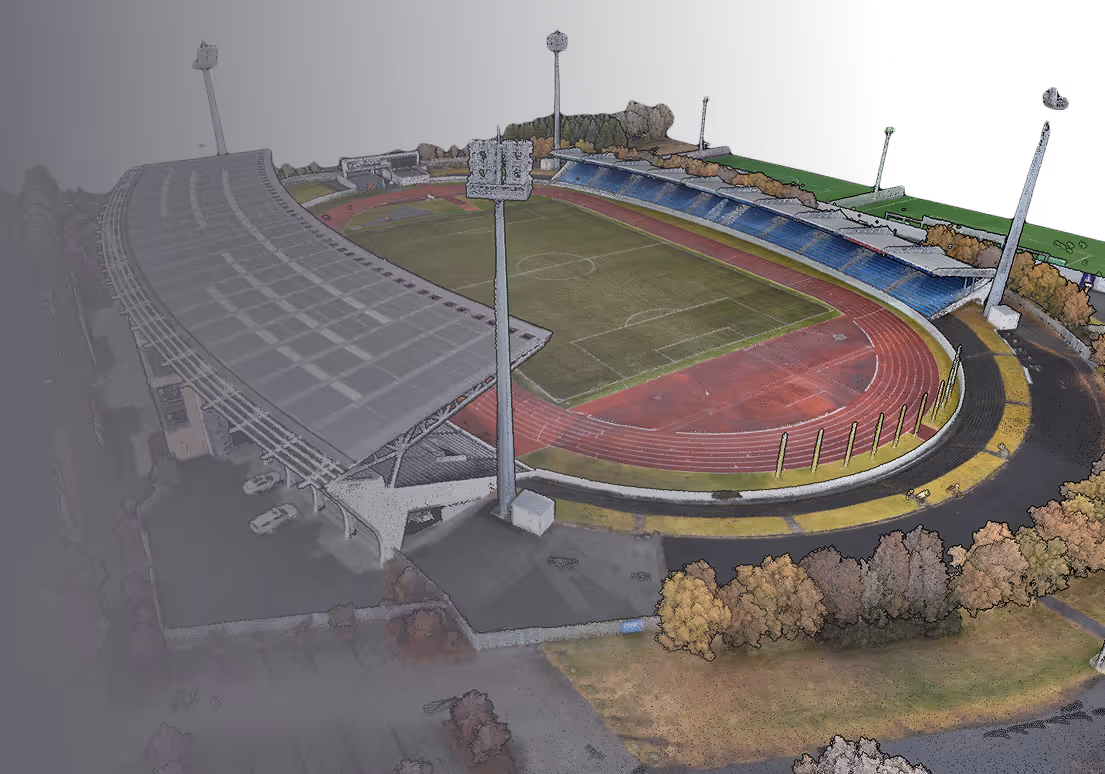
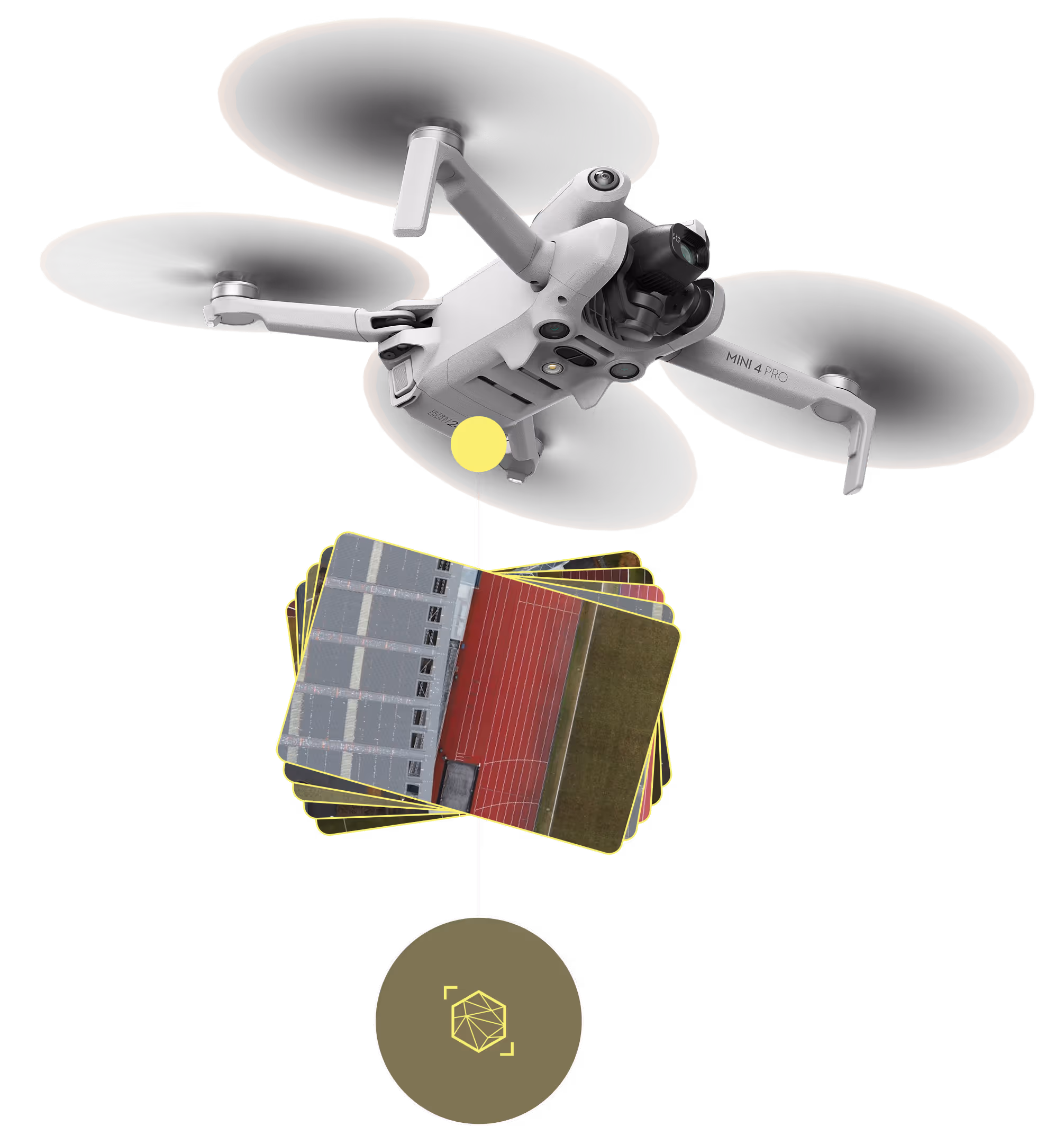
Photogrammetry engine
Access to Satellite data
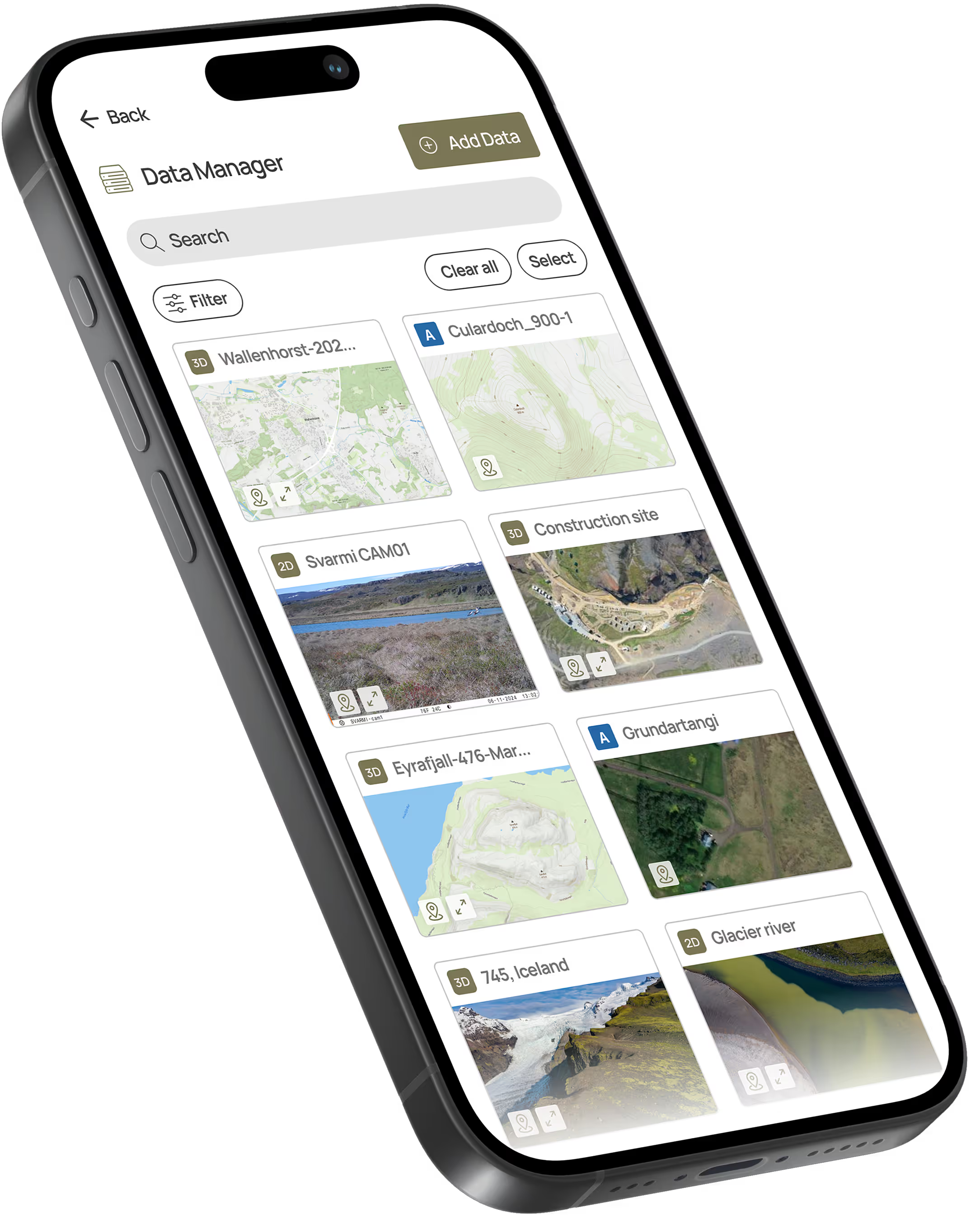
Photos & field data on the map
Asset & location-based dashboards
Transform Your Drone Photos into Stunning Maps and 3D Models
Flexible Delivery Models
Through the software solution, our clients can onboard relevant data, including data collected by our teams and third-party data from satellites and local drone operators. Our nature data management software to address this.

how it works
Effortless Photo Upload & Geo-Tagging
DATACT makes it easy to store and organize your field images, whether they come from a drone, smartphone, or camera. Users can upload multiple photos at once, and thanks to embedded GPS metadata, each image is automatically placed on the map, no manual sorting required. This way, you can streamline documentation, make it easy to track visual changes over time, and ensure your media is always connected to the right location.
Images are auto-sorted and linked to specific missions, survey areas, or observation records, enabling traceable, audit-ready data pipelines. A built-in preview panel allows users to inspect photo metadata, visualize flight paths, and filter content based on time, location, or sensor payload. Advanced users can also override default metadata with custom fields or corrected GPS tracks.
For drone-collected imagery, DATACT supports integration with mission planning outputs (e.g., flight logs, KML/CSV exports), allowing full geospatial alignment between image data and mapped flight areas. This is ideal for workflows involving orthomosaic creation, site condition monitoring, or photogrammetric processing.
Flexible Delivery Models
Integrated &
Secure
Best in class protection
Enterprise access levels
You can stream data from DATACT into a variety of common software, including ArcGIS and QGIS
Subscription Models
STARTER
For individuals or small teams beginning with drone and field data
• 1 public channel
• 1 editing user
• 2 GB of storage and
• 100 days of data history
• Basic pins for images, videos and notes
Enterprise
Scalable solutions – custom integrations and premium support
• Unlimited public channels
• Unlimited no. of internal users
• Custom storage options
• Cloud-based drone data processing
• Pins for images, videos and notes
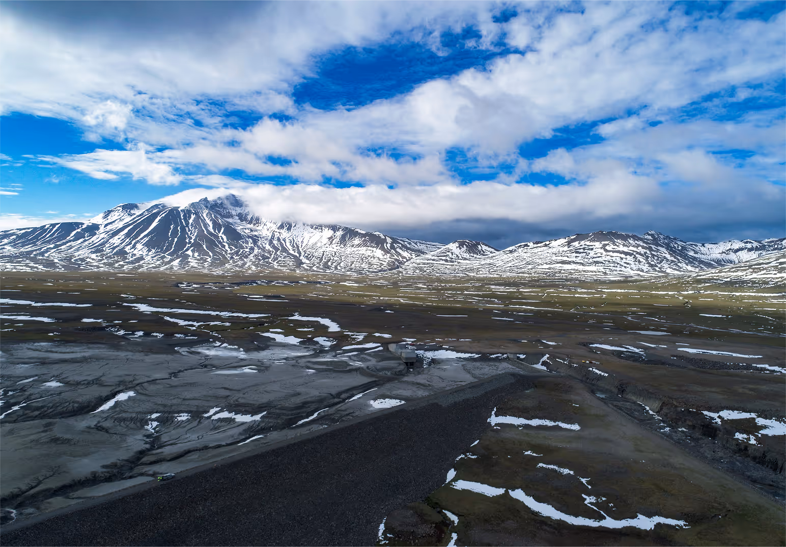
Access Satellite Data Instantly
With DATACT, users can seamlessly access high-resolution satellite imagery to complement their field and drone data. View recent and historical satellite captures of your areas of interest to monitor changes over time, assess environmental conditions, or fill in gaps between site visits. This integrated access brings a broader, consistent perspective to your nature data workflows—without leaving the platform.
Start Making Your Nature Data Work for You
